Quantcast
Channel: Archaeology – PeopleOfAr
Viewing all 92 articles
Browse latest View live

Dvin the ancient Armenian city

$
0
0
Artifacts found in Dvin, ancient capitol of Armenia

Artifacts found in Dvin, ancient capital of Armenia

Dvin was one of the most ancient settlements of the Armenian Highland and an ancient capital of Armenia, traced back as far as the 3rd millennium BC. During the excavations of 1958, a settlement of Late Bronze and Early Iron age period was discovered under the citadel of Dvin. Excavations revealed ancient workshops and worship structures from the beginning of the 1st millennium BC, with a metal workshop and four sanctuaries. The latter were large structures that had stone bases and walls made of unburnished clay. Flat roofs rested on wooden columns. Astonishing altar stelae of complex compositions, with traces of “eternal” fire and mostly black-polished utensils used at ceremonies were placed inside these sanctuaries built in the architectural traditions of Pre-Urartian (Araratian) dwellings. In the first half of the 8th century BC, Dvin and numerous settlements of the Ararat Valley were ruined due to invasions. Traces of a great fire and ruins that took place in this period are clearly seen from excavations in Dvin. According to UNESCO Dvin was also the sight of a 6th century BC. fortress.

Drawing of the central square of the ancient Armenian capital city of Dvin. The main cathedral of S. Grigor (3rd-5th century), with a small church of S. Sarkis to the right (6th century), and the residence of the Catholicos on the left (5th century).

Drawing of the central square of the ancient Armenian capital city of Dvin. The main cathedral of S. Grigor (3rd-5th century), with a small church of S. Sarkis to the right (6th century), and the residence of the Catholicos on the left (5th century).

From the first half of the 4th century, Dvin was the primary residence of the Armenian Kings of Arshakuny dynasty and the Holy See of the Armenian Church. King Khosrov II built a palace (in 335 AD.) on the site of an ancient settlement making Dvin the capital of Armenia and subsequently the seat of the Catholicos. The city grew rapidly reaching a population of over 100.000. Dvin prospered as one of the most populous and wealthiest cities east of Constantinople. Dvin quickly turned into a regional economic center, a meeting-point of trade routs from east and west. Six trade routes started from Dvin, which connected the city with Iran, Iraq, Assyria, the Byzantine Empire and countries of the Mediterranean basin. Goods manufactured in the renowned workshops of these countries were imported into Dvin. Production of the craftsmen of Dvin (pottery and textiles) was exported far beyond the borders of the country. It was the center of craftsmanship and transit commerce. In the central district of the city the Armenian Patriarch’s residence was situated with its churches and patriarchate. The city was situated on a hill, on top of which stood the old Citadel and the adjacent buildings. The city had defensive walls formed of two layers, and a temple tower. 

Ruins of Dvin ancient settlement

Ruins of Dvin ancient settlement

After the fall of Arshakuny dynasty, Dvin still remained the largest city of Armenia. At the end of 7th century, as a result of Arab invasions, Dvin and most of Armenia came under the power of the Arab Caliphate. The Arabs formed an administrative unit of Armenia, whose center was Dvin. From the beginning of the 8th century, during the Arab rule, Dvin was again a prosperous free-trade city of crafts and goods. Armenian and foreign written sources call Dvin the “Great Capital”. Despite the fact that Dvin was a battleground between Arabs and Byzantine forces for the next two centuries, in the 9th century, it was still a flourishing city. In 1236 Dvin was invaded by Tatar Mongols. Though It was destroyed and robbed, it managed to survive one more century. The last time the city of Dvin had been mentioned was in one of the Georgian chronicles along with other ruined cities. At the site of the ruined city several small villages were built which have survived until present days.

Dvin was the birthplace of Najm ad-Din Ayyub and Asad ad-Din Shirkuh bin Shadhi, Kurdish generals in the service of the Seljuks; Najm ad-Din Ayyub’s son, Saladin, was the founder of the Ayyubid dynasty of Egypt. Saladin was born in Tikrit, Iraq, but his family had originated from the ancient city of Dvin.

The archaeological sites at Dvin are inscribed in UNESCO. Numerous wonderful artifact uncovered at the sight attest to the high level of craftsmanship practiced by the ancient inhabitants of Dvin.


Small pitcher with an image of a musician 11th c., Dvin, glass

Small pitcher with an image of a musician 11th c., Dvin, glass


Vessel with zoomorphic handles, green, glazed12th-13th cc., Dvin, clay

Vessel with zoomorphic handles, green, glazed12th-13th cc., Dvin, clay


Capital with the high relief of mother and child, Dvin 5th 6th cc

Capital with the high relief of mother and child, Dvin 5th 6th cc


Capital with the crucifixion scene and the image of st. George

Capital with the crucifixion scene and the image of st. George


Glazed dish Dvin 12th 13th c

Glazed dish Dvin 12th 13th c


Glazed tray from Dvin 12th 13th c

Glazed tray from Dvin 12th 13th c


Glazed tray from Dvin 9th c

Glazed tray from Dvin 9th c


Glazed dish from Dvin 11th-12th c

Glazed dish from Dvin 11th-12th c


Glazed dish from Dvin 11th-12th c

Glazed dish from Dvin 11th-12th c


Dish 9th-10th cc., Dvin, clay

Dish 9th-10th cc., Dvin, clay


Small pitcher, engraved, with one handle, dvin 9th - 11th cc.

Small pitcher, engraved, with one handle, Dvin 9th – 11th cc.


Dish with an image of an eagle, dvin, 12th-13thc

Dish with an image of an eagle, Dvin, 12th-13thc


Dish with an image of a winged Sphinx 11th-12th cc., Dvin

Dish with an image of a winged Sphinx 11th-12th cc., Dvin


Fragment of a stamped karas-vessel band with lion images10th-11th cc., Dvin, clay

Fragment of a stamped karas-vessel band with lion images10th-11th cc., Dvin, clay


Cover of a karas-vessel or tonir (big jar dug in the earth in which fire is made, used for baking bread)9th-13th cc., Dvin, clay

Cover of a karas-vessel or tonir (big jar dug in the earth in which fire is made, used for baking bread)9th-13th cc., Dvin, clay


Pitcher, red-polished11th -12th cc., Dvin

Pitcher, red-polished11th -12th cc., Dvin


Karas, red-polished with ornamented bands10th-11th cc., Dvin, clay

Karas, red-polished with ornamented bands10th-11th cc., Dvin, clay


Stone head with Armenian tiara, ca. first century A.D., from Dvin

Stone head with Armenian tiara, ca. 1st century A.D., from Dvin


Ruins of Dvin ancient settlement

Ruins of Dvin ancient settlement


Ruins of Dvin ancient Armenian city

Capital of S. Grigor Cathedral. 4th c AD.


St. Harutyun Church in Dvin was built in 2000

St. Harutyun Church in Dvin was built in 2000


Sources:

http://whc.unesco.org/en/tentativelists/8/

http://en.wikipedia.org/wiki/Dvin

http://www.noyantour.com/sights/dvin.html

http://www.historymuseum.am/expositions/?id=15&lang=eng

http://www.historymuseum.am/expositions/?id=3&lang=eng

http://www.planeta.am/?module=article&utility=show_tour&id_article=125&lang=eng&id_category=8&type=places


Long lost Armenian monastery found inside a rock!

$
0
0
Partial views of the south-western chapel of Tzarakar Monastery

Partial views of the south-western chapel of Tzarakar Monastery

The discovery

The renown ancient Armenian monastery complex ‘Tzarakar’ has been discovered near the village of Chukurayva, 5 kms south-east of the fortified town of Kechror, modern-day Turkey (the old Gabeghiank district, Ayrarat province of Greater Armenia). What remains of it are the interior cut-in-rock structures, the exterior buildings are irretrievably lost.

The monastery consists of a church which has several entrances connected with each other, at least six chapels and other adjoining buildings. It is remarkable for its very interesting structure and extended lapidary inscriptions. Despite it, however, until recently neither specialists nor topographers ever paid any attention to it.

It was only in the late 19th and 20th century that the monument was first visited by specialists. Scottish researcher Stephen Sim, took photographs of it and made its first schematic plan. Later it was visited by seismologist Shiro Sasano, who published a small-scale research work on it together with several photographs he had taken there in 2009.

In this way, these foreign researchers discovered the cut-in-rock monastery and made it known to the scientific world. They, however, failed to find out its name and called it after the adjacent village presently inhabited by Kurds.

Understanding the importance of conducting comprehensive studies in the monastic complex, in 2010 the members of Research on Armenian Architecture conducted scientific expeditions and revealed a lot of information relating to it. The available sources attest that this newly-discovered monument complex is the monastery of Tzarakar, which is mentioned in medieval records, and the location of which remained unknown until very recently.

Among others the following facts give grounds for identifying the newly-found monastery with Tzarakar:

Tzarakar Monastery and Prut (nowadays Chukurayva) Village from space

Tzarakar Monastery and Prut (nowadays Chukurayva) Village from space

As is known, Tzarakar was one of the renowned monastic complexes in medieval Armenia, but in the course of centuries, it lost its glory and significance and was consigned to oblivion to such an extent that in our days even its location remained obscure.

Late 19th century, Gh. Alishan used the available sources to point to the area where the monastery could have possibly been situated: “…Tzarakar, which is mentioned in some works by historiographers and geographers, is known to have stood in a naturally impregnable site in the vicinity of Kechror: first of all, a cut-in-rock monastery was erected…”

S. Eprikian came to the same conclusion: “Supposedly, a monastery of this name and a village used to be situated near Kechror, Gabeghenk District, Ayrarat [Province].

The colophon of an Ashkharatsuyts (a geographical work), dating back to 1656, also confirms: “…the district of Gabeghenits and the castle of Kaput also called Artagereits—the town of Kechror is situated there together with the cut-in-rock monastery of Tzarakar, where Archimandrite Khachatur Kecharetsi’s grave is found…”

This passage reveals two facts of the utmost importance: firstly, Tzarakar Monastery was cut in the rock, and secondly, most presumably, it was situated not far from the town of Kechror. That Khachatur Kecharetsi, a worker of education and a poet who lived between the 13th and 14th centuries, was buried somewhere near Kechror, is also attested by the following note on a map of 1691 compiled by Yeremia Chelebi Kyomurjian: “Town of Kechror, bordering on Basen, and Archimandrite Khachatur’s grave.” These two records clarify that the monastery of Tzarakar was truly located near the fortress town of Kechror.

Wood-like rings inside the rock, hence the Armenian name Tzarakar (tree-stone) Monastery.

Wood-like rings inside the rock, hence the Armenian name Tzarakar (tree-stone) Monastery.

Besides written records, the etymology of the toponym of Tzarakar was also of importance to its identification. Every visitor may easily see that the structures of the monastic complex are cut into quite friable masses of rock which are naturally striped and have certain coloring, looking like the parallel circular lines showing the age of a cut tree—evidently, the name of Tzarakar, the Armenian equivalent for Tree Stone, is conditioned by this resemblance meaning a monastery cut into a tree-like stone.

Inscriptions in the monastery

The primary sources casting light on the historical events connected with Tzarakar are three lapidary inscriptions preserved in the monastery, though they have reached us in a very deteriorated state. The first of them is carved on its western facade: it is marked with irregularity of writing, for its 11 lines and the size of its letters do not seem to have any order. It is a donation inscription dated 952 mentioning Tiran, spiritual shepherd of Vanand District, and Bishop Sahak Amatuny.

An 11-line inscription carved on the western wall of the church of Tzarakar Monastery

An 11-line inscription carved on the western wall of the church of Tzarakar Monastery

Tracing outline of the 11-line inscription carved on the western wall of the church of Tzarakar

Tracing outline of the 11-line inscription carved on the western wall of the church of Tzarakar

Translation:  This is written by Tiran, spiritual shepherd of Vanand… shahanshah… gardener… St. Grigor … for my soul’s sake… may those who object to this writing be cursed by God, as well as …Tiran and Bishop Sahak Amatuny… Hakob… may he who fulfills the commands be blessed and he who raises an objection to this writing be damned and fall into the devil’s hands.

Another extended donation inscription of 17 irregular lines, dating from the same period, i.e. 10th century, has come down to our days in a semi-distorted state. It is engraved on the northern wall of the same church and is especially important as it mentions the founder of Vanand (Kars) Kingdom, Mushegh.

A 17-line inscription carved on the northern wall of the church of Tzarakar Monastery.

A 17-line inscription carved on the northern wall of the church of Tzarakar Monastery.

Tracing of the 17-line inscription carved on the northern wall of the church of Tzarakar Monastery.

Tracing of the 17-line inscription carved on the northern wall of the church of Tzarakar Monastery.

Translation:  …St. Grigor …handwriting… For God’s sake… Armenian King Mushegh… the monastery and churches on the order of Father… after my departure… is cursed… those who carry out the orders… may be blessed…

The third inscription, dated 952 like the first one, is even more distorted and consists of at least four lines (we are not sure about the existence of the fifth one). A considerable part of it has already been irretrievably lost due to natural corrosion and certain vandalistic actions probably committed by those searching for treasure in the monastery. At present only the following is legible from the inscription:

The remnants of an inscription 952AD., originally comprising at least four lines, preserved on the entrance tympanum of the porch adjoining the monastic church in the south.

The remnants of an inscription 952AD., originally comprising at least four lines, preserved on the entrance tympanum of the porch adjoining the monastic church in the south.

Translation: In the year 401 (952) of the Armenian calendar …Tiran…

The interior and concha of the caved hall located in the north-west of Tzarakar Monastery

The interior and concha of the caved hall located in the north-west of Tzarakar Monastery

Another donation inscription which fully shares the writing style of the aforementioned ones can be discerned inside a cut-in-rock hall located north-west of Tzarakar and ending in a concha (it is decorated with a cross):

Translation: May Lord Jesus Christ have mercy. Amen.


Further history of Tzarakar is elucidated by pieces of scanty information reported by Armenian historiographers. In 1028 the monastery was renovated and made suitable for serving as a castle. In 1029 it is mentioned in connection with some construction activity unfolded there by Prince West Sargis. Kirakos Gandzaketsi writes the following about the work unfolded in the late 1020s: “In his day the very distinguished Vest Sargis, after building many fortresses and churches, built the glorious monastery of Xts’konk’ and a church in the name of Saint Sargis; and making Tsarak’ar monastery a fortress, he built stronger walls and glorious churches in it.” Information relating to this building activity is also reported by Mkhitar Ayrivanetsy.

The next record dates from 1178, when Turkish conqueror Gharachay took Kechror and the fortified monastery of Tzarakar: “On the same day, he took Tzarakar from some thieves on the order of Emir Gharachay of Kechror and sold it to Khezelaslan for much gold. And he settled it with dangerous men who did not cease bloodshed day and night until the Christians were exposed to darkness and famine…, with five clergymen being stabbed crosswise.”

In 1182 Gharachay, who still held Tzarakar under his reign, destroyed the renowned Gorozu Cross kept there: “In 631 [of the Armenian calendar] Kharachay, who had conquered Tzarakar, overthrew the cross named Gorozo with a crane…” Within a short time, in 1186 the Armenians of Ani liberated Tzarakar through united forces: “In 635 [of the Armenian calendar] the inhabitants of Ani took the paternal  estate of Barsegh (the bishop of Ani), mercilessly slaughtering those who were there, except the women and children.”

The sources of the subsequent centuries make almost no mention of the monastery. However, taking into account the fact that prominent poet and worker of education Khachatur Kecharetsy was buried there in the 14th century, we can suppose that it actively continued its existence between the 13th and 14th centuries. Presumably, Tzarakar was finally ruined between 1829 and 1830, after the mass displacement and emigration of the local Armenian natives.

Architecture

The conchas of the hall and sanctuary of the main church of Tzarakar Monastery

The conchas of the hall and sanctuary of the main church of Tzarakar Monastery

The only surviving parts of Tzarakar Monastery are those of its structures which are cut in the rock, and therefore, are difficult to destroy, whereas the others have been irretrievably lost. For this reason, at present the complex is considered as only a cut-in-rock one consisting of 6 chapels and a main cruciform church with a pseudo-dome surrounded with annexes.

The plan of Tzarakar Monastery and the mountain facade overlooking the south ¥measurement and graphical design by architect Ashot Hakobian, 2010

The plan of Tzarakar Monastery and the mountain facade overlooking the south measurement and graphical design by architect Ashot Hakobian, 2010

The plan of Tzarakar Monastery and the mountain facade overlooking the south measurement and graphical design by architect Ashot Hakobian, 2010

The plan of Tzarakar Monastery and the mountain facade overlooking the south measurement and graphical design by architect Ashot Hakobian, 2010


It is evident that the rock into which the monastic structures were cut is quite friable, and for this reason, it was found expedient to cover the walls with a layer of plaster to make them solid enough to bear mural paintings and inscriptions.

The next cut-in-rock structure which comes second to the main church by its dimensions stands near the south-western corner of the latter. It almost shares the composition of the first church, but it is smaller. Its only entrance, which opens from the east, also serves as a means of communication with an adjacent hall. The structure is illuminated through its only window opening from the south. The chapel shares the decoration of the church: a relief of an equal-winged cross, covered with red paint, adorns the central part of the semi-circular concha, which joins the underdome square through squinches. Reliefs of equal-winged crosses were wide-spread in many other districts of Armenia and can be found in numerous monuments of the early Christian period. Such reliefs were carved throughout the Armenian Highland after the adoption of Christianity as the official religion of Armenia.

The hall situated between the church of Tzarakar Monastery and the chapel of its south-western corner

The hall situated between the church of Tzarakar Monastery and the chapel of its south-western corner

The hall situated between the church of Tzarakar Monastery and the chapel of its south-western corner4

The hall situated between the church of Tzarakar Monastery and the chapel of its south-western corner.


There is a structure (3.98 x 2.82 meters) between the chapel and the church which serves as an entrance hall for both of them. It is remarkable for its peculiar architectural features: it has an octahedral covering which rests on the intersecting semi-arches of the upper sections of the walls—a similar covering can be particularly seen in monuments of the 9th to 11th centuries, such as Horomos, etc. As a result of continual corrosion, the floor of this entrance hall is at present totally ruined: as a rule, friable rocks rapidly get weathered and slip downwards like sand.

The western chapel/sacristy (3.37 x 1.80 metres) is remarkable for its composition, decoration and architectural features. Its bema is higher than the floor of the prayer hall. It has a cut-in-rock altar rising at a height of 1.10 meter above the floor of the bema. Another cut-in-rock monument of the complex is a chapel located near the southern side of the church bema. Like the other two ones, it may be regarded as the third vestry of the church.

Source: http://www.raa-am.com/vardsk-4/Vardzk-4E.pdf


Bellow more images from the monastery:

A general view of Tzarakar Monastery from the south

A general view of Tzarakar Monastery from the south


The south-eastern entrance of Tzarakar Monastery with the remnants of the inscription of 952 and its plan according to Stephen Sim 1999

The south-eastern entrance of Tzarakar Monastery with the remnants of the inscription of 952 and its plan according to Stephen Sim 1999


The interior of the church of Tzarakar Monastery towards the north-east, south-east, south-west and its north-western squinch

The interior of the church of Tzarakar Monastery towards the north-east, south-east, south-west and its north-western squinch


The interior of the church of Tzarakar Monastery towards the north-east, south-east, south-west and its north-western squinch.

The interior of the church of Tzarakar Monastery towards the north-east, south-east, south-west and its north-western squinch.


The interior of the church of Tzarakar Monastery towards the north-east, south-east, south-west and its north-western squinch.

The interior of the church of Tzarakar Monastery towards the north-east, south-east, south-west and its north-western squinch.


The concha of the south-western chapel of Tzarakar Monastery; its interior to the sanctuary (north); its north-western squinch and south-western wall pylon

The concha of the south-western chapel of Tzarakar Monastery; its interior to the sanctuary (north); its north-western squinch and south-western wall pylon


Tzarakar Monastery. A cross-section towards the north measurement by architect Ashot Hakobian, 2010

Tzarakar Monastery. A cross-section towards the north measurement by architect Ashot Hakobian, 2010


The concha of the south-western chapel of Tzarakar Monastery; its interior to the sanctuary (north); its north-western squinch and south-western wall pylon-3

The concha of the south-western chapel of Tzarakar Monastery; its interior to the sanctuary (north); its north-western squinch and south-western wall pylon.


Partial views of the south-western chapel of Tzarakar Monastery

Partial views of the south-western chapel of Tzarakar Monastery


The hall situated between the church of Tzarakar Monastery and the chapel of its south-western corner2

The hall situated between the church of Tzarakar Monastery and the chapel of its south-western corner.


The hall situated between the church of Tzarakar Monastery and the chapel of its south-western corner3

The hall situated between the church of Tzarakar Monastery and the chapel of its south-western corner


Tzarakar Monastery. Partial views of the interior of the chapel vestry standing in the north-east of the church

Tzarakar Monastery. Partial views of the interior of the chapel vestry standing in the north-east of the church

Tzarakar Monastery. Partial views of the interior of the chapel vestry standing in the north-east of the church

Tzarakar Monastery. Partial views of the interior of the chapel vestry standing in the north-east of the church


Tzarakar Monastery. Partial views of the interior of the chapel vestry standing in the north-east of the church3

Tzarakar Monastery. Partial views of the interior of the chapel vestry standing in the north-east of the church


Tzarakar Monastery. The ceiling and western wall of the chapel sacristy located south of the sanctuary of the monastic church

Tzarakar Monastery. The ceiling and western wall of the chapel sacristy located south of the sanctuary of the monastic church


Tzarakar Monastery. The ceiling and western wall of the chapel sacristy located south of the sanctuary of the monastic church

Tzarakar Monastery. The ceiling and western wall of the chapel sacristy located south of the sanctuary of the monastic church


Tzarakar Monastery. A remnant of an equal-winged cross in red paint on the plaster

Tzarakar Monastery. A remnant of an equal-winged cross in red paint on the plaster


The sanctuary of the chapel standing at the eastern edge of Tzarakar Monastery

The sanctuary of the chapel standing at the eastern edge of Tzarakar Monastery


Tzarakar Monastery. Partial views of the interior of the chapel vestry standing in the north-east of the church

Tzarakar Monastery. Partial views of the interior of the chapel vestry standing in the north-east of the church


Research team visit to Tzarakar Monastery in 2010

Research team visit to Tzarakar Monastery in 2010


The excavation of the temple complex Ogmik in Armenia will aid comprehensive study on pagan Armenian culture

$
0
0

Excavation Pagan templeExcavation of a pagan temple complex Ogmik in the village near the town of Amasia, will help to thoroughly examine the pagan Armenian culture, said the head of the group of archaeologists of the Institute of Archeology and Ethnography of the National Academy of Sciences of Armenia, Professor Hayk Hakobyan.

Excavations of the pagan complex began in 1988 and lasted until 1993, by a team of archaeologists led by Hagopian. The work halted in 1993 and was only resumed in 2006 continuing to this day.

“Excavations in the area are of great importance for the evaluation of the ancient pagan life in the country. For a long time it was thought that after the adoption of Christianity, the pagan temples in Armenia have been destroyed, that is not true, “- said Hakobyan to reporters on Monday.

He explained that the results of numerous archaeological excavations, which began in the 50s of the last century show that such temples were not destroyed, and, in addition to Garni temple, the ruins of temples are also preserved in Erebuni, Oshakan and Shirak.

“Best traces of pagan culture of Armenia are preserved in the ancient village of Ogmik where the excavations had revealed a large temple complex in an area of ​​over 10 hectares. To date, we have studied only about 10% of the territory, “- said Hakobyan.

According to the archaeologist, currently in Ogmik they found temples dedicated to gods of the ancient Armenian pagan pantheon, such as Anahit (mother goddess, the goddess of fertility and love) and Aramazd (the supreme god in the pantheon of ancient Armenia, creator of heaven and earth, the god of fertility, the father of the gods ), as well as elements of sacrificial altars, rooms in which are found the remains of sacrificed animals, statues, stones carved with symbols.

Judging by the results of the excavations, the ancient settlement functioned for 400 years or longer from the 2nd century BC until the end of the third century AD, when Christianity in Armenia was adopted as the state religion.

“The excavation will continue, however due to lack of funding, work is going very slowly,” – said Hakobyan.

Armenian paganism – a polytheistic religion of the Armenians is closely connected with the Armenian mythology and prevailed prior to the adoption of Christianity in Greater Armenia in 301 AD.

Pantheon of Armenian gods, that was formed during the early days of proto-Armenian formation, inherited and preserved the essential elements of proto-Indo-European tribes inhabiting the Armenian highlands.

Garni Temple that is preserved in Armenia  is a monument belonging to the era of paganism and Hellenism. It is believed that it was dedicated to the pagan solar deity – Mihr or Mher.

As a result of a major earthquake in 1679, the temple was almost completely destroyed, it was restored in 1966-1976. Outside the temple, the remains of an ancient fortress and royal palace, as well as the bath house, built in the III century, were discovered. The building is comprised of at least five different rooms, four of which were on the sides of the apse. The floors are decorated with Hellenistic mosaics.

Armenia was the first country to adopt Christianity as a state religion in the year 301.

Source: http://www.yerkramas.org/2013/10/07/raskopki-xramovogo-kompleksa-ogmik-v-armenii-pomogut-kompleksno-izuchit-yazycheskuyu-kulturu/


Pagan temple complex in Armenia unravels the mystery of ancient offerings

$
0
0
Scenery from Shirak Province, Harichavank complex (7th century AD).

Scenery from Shirak Province, Harichavank complex (7th century AD).

A temple complex is being excavated in Ogmik, the northwest of Armenia’s Shirak province, archeologist Hayk Hakobyan told journalists on Monday.

“We have already found altars, idols and clay figures and carcasses of animals offered to gods. More specifically, dogs and deer were offered to Anahit and Astghik, goats to Vahagn. On one of the altars we have even found a human skull,” Hakobyan said.

He said that the temple complex was built in II BC and was active till IV AD. “So, we see that not all pagan temples were destroyed after the adoption of Christianity. The complex in Ogmik was not ruined but just stopped its activities,” Hakobyan said.

He said that the excavations in Ogmik were started in the late 1980s and resumed in 2006. “If continued at the current pace, they may last for as long as 80-100 years,” Hakobyan said.

Source: http://www.arminfo.am/index.cfm?objectid=A67B06A0-2F4B-11E3-83250EB7C0D21663


Ereruyk basilica – 5th century

$
0
0
Ruins of Ereruyk basilica, 5th century

Ruins of Ereruyk basilica, 5th century

The Ereruyk basilica is one of the most popular monuments of ancient architecture of Armenia. The Basilica is located on the eastern banks of the River Arax, facing the City of Ani, in the Shirak Province of Greater Armenia. It has a very special place among the early christian Basilica churches, as it is one of the classic examples built in the 5th century . It is considered the highest achievement of the early Armenian ecclesiastical architecture and contains clues to the origin and formulation of Armenian architecture. It is made of fine and hardy red tufa or tuff.

A detailed architectural reconnaissance was done in late XIXth and early XXth centuries by the talented Armenian architectural archaeologist, T’oros Toramanian, who made detailed sketches and drew reconstruction drawings of the Ereruyk Basilica which help us better understand the original state of the intact Basilica. The southern portal which has been relatively well preserved (with most of the ornate carvings in tact) in of itself represents a rich and creative craftsmanship.

Bellow more pictures:

Ruins of Ereruyk basilica, 5th century

Ruins of Ereruyk basilica, 5th century

Ruins of Ereruyk basilica, 5th century

Ruins of Ereruyk basilica, 5th century

Ruins of Ereruyk basilica, 5th century

Ruins of Ereruyk basilica, 5th century

Ruins of Ereruyk basilica, 5th century

Ruins of Ereruyk basilica, 5th century

Ereruyk basilica blueprint


Yerevan turns 2795, Congratulation!

$
0
0

Yerevan 2795 city Erebuni

Yerevan is the capital and largest city of Armenia and one of the world’s oldest continuously inhabited cities. Today marks the 2795th anniversary of the foundation of the capital city of Erebuni-Yerevan. Celebrations in its honor are held in the capitol with music, dances  life performances and various other cultural activities.

Founded by the Arartian King Argishti I in the 8th century BC , Yerevan was the contemporary of Babylon predating Rome and Carthage. The city’s name Yerevan is an evolution of its early name Erebuni. Archaeological evidence, such as a cuneiform inscription, indicates that the Araratian fortress Erebuni (Էրեբունի) was founded by the orders of King Argishti I at the site of current-day Yerevan, to serve as a fort and citadel guarding against attacks from the north Caucasus. Yerevan, as mentioned, is one of the most ancient cities in the world. During the height of Araratian power, irrigation canals and an artificial reservoir were built on Yerevan’s territory.

The cuneiform inscription found at Erebuni Fortress reads:

By the greatness of the God Khaldi, Argishti, son of Menua, built this mighty stronghold and proclaimed it Erebuni for the glory of Biainili [Van] and to instill fear among the king’s enemies. Argishti says, “The land was a desert, before the great works I accomplished upon it. By the greatness of Khaldi, Argishti, son of Menua, is a mighty king, king of Biainili, and ruler of Tushpa.” [Van]

Nonetheless the territory of Yerevan-Erebuni was settled much earlier. In the fourth millennium B.C. fortified settlements from the Bronze Age include Shengavit, Tsitsernakaberd, Teishebaini, Arin Berd, Karmir Berd and Berdadzor.


Georgian name for Armenia: a short inquiry

$
0
0

Armenians are known in Georgian language as ‘Somekhi’ and the country Armenia is called ‘Somkheti’. In medieval Georgian Chronicles the region populated by Armenians was known as Somkhiti სომხითი, a geographic term referring to Armenia. In the 18th century, “Somkhiti” was largely replaced with “Somkheti” (სომხეთი) as a Georgian exonym for Armenia.  The term “Somkhiti”/”Somkheti” is presumed by modern scholars to have been derived from “Sukhmi” or “Sokhmi”, the name of an ancient land located along the upper Euphrates.

According to Professor David Marshall Lang, The name ‘Sokhmi’,[...] applied to tribes living along the upper Euphrates, seems to be perpetuated in the medieval and modern Georgian texts as a name for the Armenians in general — ‘Somekhi’, meaning ‘an Armenian’ and ‘Somkheti’ for ‘Armenia’.

It’s asserted to be a Georgian variation of the word ‘Meskhi’ from the Mushki people, one of proto-Armenian tribes populating the Armenian Highlands (as described by Diakonoff). According to Professor James R. Russell of Harvard University, the Georgian designation for Armenians ‘Somekhi’, preserves the old name of the Mushki. Pliny in the 1st century AD mentions the Moscheni in southern Armenia (“Armenia” at the time stretching south and west to the Mediterranean, bordering on Cappadocia).

The following map printed in Tiflis (old Tbilisi, Georgian capital)  in 1902, shows the region that to Georgians was known as Armenia (Somkheti, Сомхетия in Russian), encompassing the historic settlement Dmanisi (in the map shown as Думаниса in Russian). The lands populated by Armenians.

Somkhetia, Somekhi Somkhiti region known as Armenia

Somekhia the region known to Georgians from old times as Armenia, because of its population. Map is taken from N. Anosov’s “Times of Tormasov, Paulucci and Rtishchev, 1809-1817″ published in Tiflis (Tbilisi) in 1902

Follow this link to see the entire map in full detail:

http://upload.wikimedia.org/wikipedia/commons/e/ed/Map_Caucasus_War_%281809-1817%29_by_Anosov_%28A%29.jpg


Massive Urartian Cemetery Found Under Yerevan

$
0
0

BY ALISA GEVORGYAN
Source: Armenian Public Radio

Karmir-Blur

Findings at archaeological site in Armenia could shed light on a number of questions

YEREVAN—A massive cemetery found as a result of three years of archaeological excavations in the ancient site of Karmir Blur (Red Hill) in Yerevan is of huge scientific significance, says Hakob Simonyan, head of the expedition and Director of the Historical Cultural Heritage research center of the Ministry of Culture. According to him, the archaeological materials found at the site could give an answer to a number of questions about the residents of the area, their perceptions of the afterlife and their burial rituals.

Karmir Blur or Teishebaini, which is presently located near the city of Yerevan, was a provincial capital of the 9th to 6th century B.C. Kingdom of Van (better known as Urartu).

Hakob Simonyan says the Kingdom of Van has always been in the spotlight of scientists. However, no graveyard had ever been found on the huge territory until the decision was made to construct a highway bypassing Yerevan, which could only pass through Karmir Blur.

As a result of three months of research, scholars have found densely located tombs. There are 500 tombs just under the road being constructed.

The kings of Van viewed the Ararat Valley as a granary, where the finest wines were produced. Hakob Simonyan says half a million liters of wine was kept in the pantries of Karmir Blur. Huge reserves of grain were also kept in the city.

Among the most important items found at the site were the “four idols” – tuff tiles with holes in the shape of eyes. Scientists assume the idols protected the peace of the dead. It’s now unclear whether the people buried in the cemetery were from the same family, nationality or represented completely different ethnic groups. The answer to this question will become clear after a DNA test. Samples have already been sent to Copenhagen.

According to Hakob Simonyan, Karmir Blur contains exceptional archaeological material, which could give answers to a number of questions. He says as many as 5,000 artifacts could be found at the site. Where they will be kept is a different question. Scholars are confident that it’s high time for Armenia – a country with a powerful cultural heritage – to have Anthropological and Urartian Centers.

As for the excavations at Karmir Blur, Hakob Simonyan says both the Eurasian Bank and Yerevan City Hall have promised that no historic monument will be destroyed and the road will be constructed only after the area is fully investigated.


Secrets of the Kingdom of Van emerging from Armenian soil!

$
0
0

A large residence of the viceroy of the king of Urartu in Karmir Blur -Armenia is starting to emerge from the ground, revealing long lost secrets of an ancient Armenian kingdom.

Urartu burial in Karmir Blur Armenia

9th century BC. Urartu burial in Karmir Blur Armenia

In order to redirect traffic from the loaded roads of Armenia’s capitol, officials in Yerevan commissioned a construction of a highway near the territory of Karmir Blur. Before the construction could commence, experts were tasked to investigate the area and carry out several excavations. When in August archaeologists started to investigate the site, they discovered that Charbahe cemetery and the surrounding areas once served as a burial place during the Urartu period in the 9th century BC

Nowadays the kingdom of Van that was known to the Babylonians as Urartu, is attracting attention from European, American, Russian, Iranian and Turkish scientists. Urartu is mentioned several times in the Bible as Ararat. On one occasion it is described as the country of Noah’s descend after the deluge. In the trilingual Behistun inscription, carved in 521 BC by the order of Darius the Great of Persia, the country referred to as Urartu in Assyrian is called Arminiya in Old Persian and Harminuia in Elamite. Armenia, Urartu, Ararat and Herminuia are therefore synonymous.

Archaeologists leading the excavation discovered in recent months around 500 tombs, each containing at least 2 individuals. Some of which belonged to the upper class of the Ararat kingdom. During these excavations about 1,000 items were recovered, with many more yet to be extracted. These artifacts together with the human remains will help to reveal many secrets of the ancient Armenian kingdom.

The tombs resemble chambers, filled with earth, and the top covered with huge boulders plastered with lime. The knees of the discovered skeletons are bent, females lie on the left side while males on the right side. Buried with them were also servants, whose bones were divided into several parts. Aside the buried, idols were placed made of tuff tiles with holes in the shape of eyes.  They were supposed to protect their owners from evil spirits in the afterlife. Among the finds, archaeologists recovered the skeleton of a very tall woman. She wore a chased belt and a copper bracelet on her ankle.

The researches also found a cellar and a horse stable. Barns were filled with large stocks of grain and a huge area which indicates that more than half a million liters of wine was kept there.  Yet another section of the tombs, probably belonged to the workers of the ancient city.

The first stage of excavations is finished. The results have already sparked the interest of foreign scientists. Hermitage director Mikhail Piotrovsky was in Yerevan during the excavation and could not hide his excitement and amazement of the findings. 

These sensational discoveries have also sparked several questions in regards to where the artifacts, numbers of which exceeds five thousand, should be kept and where they should be displayed. Some have suggested that it is high time for Armenia to create Anthropological and Urartian Centers of their own.

These new findings will be a vital source of information on the origins, genetics and ethnicity of the people of kingdom of Van. From previous excavations of Karmir Blur we know to what civilization and culture citizens of Teishebaini belonged. These excavations will also provide comprehensive information about the funeral rites and the ancient´s representation of the afterlife.

It is worthy to note that previously no anthropological studies have been conducted in regards to the population of Kingdom of Van. Due to the large amount of discovered artifacts scientists are now able to formulate serious conclusions. Some samples from the graves are already sent to Copenhagen for DNA research.  The analysis will shed light on ancient Armenian ethnos.

To be able to conduct such research domestically Armenian scientists consider it also necessary to create an anthropological laboratory in their own country. After all, Armenia is the heir of a huge archaeological, historical and cultural heritage. Secrets of which are gradually coming to light. 

Images from the burial:

Urartu burial in Karmir Blur Armenia

Urartu burial in Karmir Blur Armenia

Urartu burial in Karmir Blur Armenia

Urartu burial in Karmir Blur ArmeniaUrartu burial in Karmir Blur ArmeniaUrartu burial in Karmir Blur Armenia

Source: http://imyerevan.com/ru/society/view/5117


Armenia: The Forgotten Paradise

$
0
0

Bellow the text that was used in the video including parts that didn’t made it into the video and a selection of maps of terrestrial Paradise:

The Biblical account of the garden of Eden has for long preoccupied the minds and imaginations of theologians, believers and countless adventurers of the past. Many have attempted to identify the location of the garden and put forward theories ranging from the underground, the north pole and even the surface of the moon. However if the location of the terrestrial paradise is to be understood according to scriptures, there is only one place that fits the description. That place is historic Armenia.

The Bible mentions a spring in the Garden which parts into four major rivers, including Tigris and the Euphrates. Tigris and Euphrates both have their headwaters in the area surrounding Mt. Ararat in historic Armenia. Many Biblical scholars have therefore placed the garden of Eden in Armenia. They have argued that posterity of Seth and Noah’s ark have remained close to Eden. Thus the birthplace of mankind is also the place of rebirth. These accounts are supported by ancient believes of the people of Mesopotamia, who often considered the Armenian Highlands to be the dwellings of the Gods (Cyclopædia of Biblical, Theological, and Ecclesiastical Literature, 1894).

In his memoirs Lord Byron writes:

“If the Scriptures are rightly understood, it was in Armenia that Paradise was placed. – Armenia, which has paid as dearly as the descendants of Adam for that fleeting participation of its soil in the happiness of him who was created from its dust. It was in Armenia that the flood first abated, and the dove alighted. But with the disappearance of Paradise itself may be dated almost the unhappiness of the country ; for though long a powerful kingdom, it was scarcely ever an independent one, and the satraps of Persia and the pachas of Turkey have alike desolated the region where God created man in his own image.”  – Armenian exercises and poetry, 1886

  • Lord Byron (1886) Armenian exercises and poetry

That Armenia was once considered the location of terrestrial Paradise can be attested from old maps and theological records. See blow for the maps.

Alessandro Scafi (2007) in his work “Finishing the unfinished: Paradise in Fausto da Longiano’s vernacular translation of Piccolomini’s Cosmographia (1544), describes Fausto and his thoughts on the location of terrestrial Eden. He writes:

“As a possible location, Fausto (1544) proposed Armenia, a region which in the sixteenth century included the area between the upper Euphrates and Lake Urmia, the Black Sea and the Syrian desert. The identity of two of the four rivers named in Genesis, the Tigris and the Euphrates, was uncontroversial, and both rivers were known to rise in Armenia. The more problematic Gihon and Pishon could be identified amongst the local rivers (for Fausto, the Araxes and the Cyrus).”

  • Alessandro Scafi (2007), Finishing the unfinished: Paradise in Fausto da Longiano’s vernacular translation of Piccolomini’s Cosmographia (1544)

Joseph E. Duncan (1972) likewise recounts:

“Both Pererius and Lapide had suggested Armenia as logical location for Eden and paradise. Johann Vorstius, maintaining that Scripture clearly stated that the great river arose in Eden itself, also contended that Eden and paradise must be in Armenia.

One of the most complete of the earlier arguments for an Armenian paradise was offered by Carver in a tract publication in 1666… He found the site of Eden in Armenia Major, on the south side of Mount Taurus. He speculated that paradise might have been transformed into a nitrous lake which Pliny had said was located in this area.”

  • Joseph E. Duncan (1972) Milton’s Earthly Paradise: A Historical Study of Eden, Univ Of Minnesota Press; Minnesota Archive Editions edition (July 6, 1972)

17th century French scholar Joseph Pitton de Tournefort writes:

“And if we may suppose the Terrestrial Paradise to have been a place of considerable extent, and to have retained some of its beauties, notwithstanding the alterations made in the Earth at the Flood, and since that time; I don’t know a finer spot to which to assign this wonderful place, than the Country of the Three-Churches (Echmiadzin-Armenia), about twenty French leagues distant from the Heads of Euphrates and Araxes, and near as many from the Phasis.” – A Voyage Into the Levant (1741)

In their Encyclopedia of Biblical, Theological, and Ecclesiastical literature (1894), John McClintock and James Strong recount nine principal theories of the proposed location of earthly paradise. Armenia is considered the most likely location of Eden.

“The opinion which fixes Eden in Armenia we have placed first, because it is that which has obtained most general support, and seems nearest the truth. (See No. vi.) For if we may suppose that, while Cain moved to the East (Gen. iv, IG), the posterity of Seth remained in the neighborhood of the primeval seat of mankind, and that Noah’s ark rested not very far from the place of his former abode, then Mount Ararat in Armenia becomes a connecting point between the antediluvian and post-diluvian worlds (Gen. viii, 4)”

Eden is shortly described as follows:

“Eden was a tract of country, and that in the most eligible part of it was the Paradise, the garden of all delights, in which the Creator was pleased to place his new and pre-eminent creature, with the inferior beings for his sustenance and solace.”

  • John McClintock & James Strong (1894) Cyclopædia of Biblical, Theological, and Ecclesiastical Literature.

“As nearly as we can gather from the Scriptural description, Eden was a tract of country, the finest imaginable, laying probably between the 35th and the 40th degree of N. latitude, of such moderate elevation, and 80 adjusted, with respect to mountain ranges, and watersheds, and forests, as to preserve the most agreeable and salubrious conditions of temperature and all atmospheric changes. Its surface must therefore have been constantly diversified by hill and plain. In the finest part of this land of Eden, the Creator had formed an enclosure, probably by rocks, and forests, and rivers, and had filled it with every product of nature conducive to use and happiness. Due moisture, of both the ground and the air, was preserved by the streamlets from the nearest hills, and the rivulets from the more distant; and such streamlets and rivulets, collected according to the levels of the surrounding country (“it proceeded from Eden”) flowed off afterwards in four larger streams, each of which thus became the source of a great river.

Here, then, in the south of Armenia, after the explication we have given, it may seem the most suitable to look for the object of our exploration, the site of Paradise.”

  • John McClintock & James Strong (1894) Cyclopædia of Biblical, Theological, and Ecclesiastical Literature.

That the Biblical rivers cannot be identified with Nile (as some would claim) is described as follows:

“That the Hiddekel (this name is said to be still in use among the tribes who live upon its banks—Col.Chesney, Erp. to Tigris and Euphrates, i, 13) is the Tigris, and the Phrath the Euphrates, has never been denied, except by those who assume that the whole narrative is a myth which originated elsewhere, and was adapted by the Hebrews to their own geographical notions. As the former is the name of the great river by which Daniel sat (Dan. x, 4), and the latter is the term uniformly applied to the Euphrates in the Old Testament, there seems no reason to suppose that the appellations in Gen. ii, 14 are to be understood in any other than the ordinary sense. One circumstance in the description is worthy of observation. Of the four rivers, one, the Euphrates, is mentioned by name only, as if that were sufficient to identify it. The other three are defined according to their geographical positions, and it is fair to conclude that they were therefore rivers with which the Hebrews were less intimately acquainted. If this be the case, it is scarcely possible to imagine that the Gihon, or, as some say, the Pison, is the Nile, for that must have been even more familiar to the Israelites than the Euphrates, and have stood as little in need of a definition.”

  • John McClintock & James Strong (1894) Cyclopædia of Biblical, Theological, and Ecclesiastical Literature.

That Eden is described in a post-deluvian manner as opposed to the Lutherian idea of geography being altered due to the flood is explained as follows:

“Nor will it do to suppose that in former ages great changes had taken place, which have so disguised the rivers in question that their course, connection, and identity are not now traceable ; for two of the rivers, at least, remain to this day essentially the same as in all historic times, and the whole narrative of Moses is evidently adapted to the geography as it existed in his own day, being constantly couched in the present tense, and in terms of well-known reference as landmarks.

Luther, rejecting the forced interpretations on which the theories of his time were based, gave it as his opinion that the garden remained under the guardianship of angels till the time of the Deluge, and that its site was known to the descendants of Adam ; but that by the flood all traces of it were obliterated. But, as before remarked, the narrative is so worded as to convey the idea that the countries and rivers spoken of were still existing in the time of the historian. It has been suggested that the description of the garden of Eden is part of an inspired antediluvian document (Morren, Rosenmiiller’s Geogr. i, 92). The conjecture is beyond criticism ; it is equally incapable of proof or disproof, and has not much probability to recommend it. The effects of the flood in changing the face of countries, and altering the relations of land and water, are too little known at present to allow any inferences to be drawn from them.”

  • John McClintock & James Strong (1894) Cyclopædia of Biblical, Theological, and Ecclesiastical Literature.

In his memoirs “Armenia, travels and studies” famous Brit  H. F. B. Lynch writes:

“What attracted me to Armenia? One inducement was curiosity : what lay beyond those mountains, drawn in a wide half-circle along the margin of the Mesopotamian plains? The sources of the great rivers which carried me southwards, a lake with the dimensions of an inland sea, the mountain of the Ark, the fabled seat of Paradise.”

  • Armenia, travels and studies H. F. B. Lynch (1901)

During her travels in Armenia, missionary Maria A. West wrote:

“This is the Christian Crusade of the nineteenth century ; far exceeding in moral sublimity that of the olden time, when the kings of the earth banded themselves together to rescue the Holy Land from the hand of the Turk ! How wonderful that the Great Commission, the Master s last Command, uttered in this very land, more than eighteen hundred years ago, should have been caught up, and re-echoed in the New World, by a nation not yet a century old ! That scores of its sons and daughters should carry the “ glad tidings” from the Caspian and Black Seas on the north, beyond the Mediterranean on the south : In the country of Eden, and Ararat, the cradle of the human race.”

  • Maria a. West (1875), Romance of Missions: or, Inside Views of Life and Labor, Land of Ararat.

“A lovely lake, like that of Galilee, sleeps within their embrace; a branch of the Euphrates curves its gleaming arm around this wondrous mosaic of emerald and agate, carnelian and onyx, with the golden sunlight resting upon embowered villages, of which we count twenty-five without, and fifty with the aid of a glass, their beaten paths crossing and recrossing the plain, in every direction.

It may indeed have been, as the people say, “the very Garden of Eden”  where Adam and Eve together watched the opening of blushing flowers and the ripening of luscious fruits, after the marriage ceremony “ the crowning”  as the Orientals call it had been performed ; for, “in the day that God created man male and female created He them, and BLESSED THEM, and CALLED THEIR NAME ADAM.”  Here, perhaps, they plucked and ate the forbidden fruit, whose prolific seeds have borne bitter harvest all over the face of the wide, wide world !”

  • Maria a. West (1875), Romance of Missions: or, Inside Views of Life and Labor, Land of Ararat.

And this lost Paradise, so long trodden under foot by the Destroyer, “her hedges broken down, so that all they which pass by the way do pluck her, wasted by the boar out of the wood, and devoured by the wild beast of the field:” -This vineyard, planted “eastward” -by God s “right hand” -at the opening of man’s history – (“a river went out to water it;” and from thence it was parted and became four heads ; and the fourth river is “Euphrates:”) -This long-deserted Garden is to be “regained” for the “second Adam,” and made to “blossom as the rose;” to “ blossom abundantly, and rejoice even with joy and singing ; the glory of Lebanon shall be given unto it, the excellency of Carmel and Sharon ; and the REDEEMED shall walk there.”

  • Maria a. West (1875), Romance of Missions: or, Inside Views of Life and Labor, Land of Ararat.

Our national birthday of freedom finds us on these distant heights in the land which was the cradle of the human race the land of Ararat, the country, if not the Garden of Eden, where we may suppose our first parents wandered after their expulsion from Paradise, and obtained their bread by the sweat of their brow. And we, their self-exiled children, are striving to undo the mischief which their disobedience brought on these fair plains, and among these smiling valleys and rugged mountains.

  • Maria a. West (1875), Romance of Missions: or, Inside Views of Life and Labor, Land of Ararat.

The Armenian language belongs to the Indo-Germanic family, enriched with many Sanscrit words, but having no affinity to the Semitic, or any of the more modern tongues. The people claim that it was the language of paradise, and will be the language of the heavenly world.

  • Maria a. West (1875), Romance of Missions: or, Inside Views of Life and Labor, Land of Ararat.


Selection of antique maps of terrestrial Paradise:

A Map of the Terrestrial Paradise, Emmanuel Bowwen (1780)

A Map of the Terrestrial Paradise, Emmanuel Bowwen (1780)


Fine map of the Middle East, including the Holy Land, Cyprus, Iran and Irak, etc. Philippe Buache was one of the most active proponents of the so-called "school of theoretical cartography" active in mid-18th century France. Published by Dezauche and engraved by Marie F. Duval.

Fine map of the Middle East, including the Holy Land, Cyprus, Iran and Irak, etc.
Philippe Buache was one of the most active proponents of the so-called “school of theoretical cartography” active in mid-18th century France. Published by Dezauche and engraved by Marie F. Duval.


Paradis Terrestre by Desbrulins, F. 1700-1799 source Bibliothèque nationale de France

Paradis Terrestre by Desbrulins, F. 1700-1799 source Bibliothèque nationale de France


Eden in Armenia 8th century world map from Turin

Eden in Armenia 8th century world map from Turin

Eden in Armenia 8th century world map from Turin

Eden in Armenia 8th century world map from Turin


A General Map for Information about the History of the Saints, Phillippe Buache, Published in 1783 in Paris.

A General Map for Information about the History of the Saints, Phillippe Buache, Published in 1783 in Paris.


Map of the Earthly Paradise by Moyse, 1724 Source: Bibliothèque nationale de France

Map of the Earthly Paradise by Moyse, 1724 Source: Bibliothèque nationale de France

Map of the Earthly Paradise by Moyse, 1724 Source: Bibliothèque nationale de France

Map of the Earthly Paradise by Moyse, 1724 Source: Bibliothèque nationale de France


Antique map of the Paradise, Huet  Stark-man, 1725 'Kaarte van Het Aardsche Paradys'

Antique map of the Paradise, Huet Stark-man, 1725 ‘Kaarte van Het Aardsche Paradys’


Athanasius Kircher, 1675 Topographia Paradisi terrestris juxta mentem et conjecturas

Athanasius Kircher, 1675 Topographia Paradisi terrestris juxta mentem et conjecturas


L’Arménie, jardin d’Eden, page de l’Atlas de cartographie historique de l’Arménie, Jacques Khanzadian, copie de carte ancienne, 1675

L’Arménie, jardin d’Eden, page de l’Atlas de cartographie historique de l’Arménie, Jacques Khanzadian, copie de carte ancienne, 1675


Map from the atlas Theatre of the World by Abraham Ortelius featuring Eden in Armenia. Antwerp, 1601

Map from the atlas Theatre of the World by Abraham Ortelius featuring Eden in Armenia. Antwerp, 1601


Овальная карта мира Беата (776 г.) из «Атласа истории географических открытий и исследований». Москва, 1959

Овальная карта мира Беата (776 г.) из «Атласа истории географических открытий и исследований». Москва, 1959

Увеличенный фрагмент той же карты, с подписью «Armenia regio».

Увеличенный фрагмент той же карты, с подписью «Armenia regio».


The Manchester (a.k.a. Altamira) Beatus mappamundi, ca. 1175, John Rylands Library, MS. Lat. 8, fols. 43v-44, Manchester, England

The Manchester (a.k.a. Altamira) Beatus mappamundi, ca. 1175,
The Manchester (a.k.a. Altamira) Beatus mappamundi, ca. 1175, John Rylands Library, MS. Lat. 8, fols. 43v-44, Manchester, England


The world map from the Saint-Sever Beatus painted c. 1050 A.D. as an illustration to Beatus's work at the Abbey of Saint-Sever in Aquitaine

The world map from the Saint-Sever Beatus painted c. 1050 A.D. as an illustration to Beatus’s work at the Abbey of Saint-Sever in Aquitaine


Carte Du Paradis Terrestre Suivant le Systeme de l Auteur et Execute par P. Starck-man

Carte Du Paradis Terrestre Suivant le Systeme de l Auteur et Execute par P. Starck-man


The map Tabula Paradisi Terrestris justa Systema Auctoris incisa a P. Stark-Man was printed late in the 18th century, probably around 1775..

The map Tabula Paradisi Terrestris justa Systema Auctoris incisa a P. Stark-Man was printed late in the 18th century, probably around 1775.


Topographia Paradisi terrestris juxta mentem et conjecturas authoris, Kircher, Athanasius 1675

Topographia Paradisi terrestris juxta mentem et conjecturas authoris, Kircher, Athanasius 1675


 Antique map of the Garden of Eden by Calmet - 1789

Antique map of the Garden of Eden by Calmet – 1789


Moxon's Paradise of the Garden of Eden with the Countries circumjacent inhabited by the Patriarchs, printed in 1690

Moxon’s Paradise of the Garden of Eden with the Countries circumjacent inhabited by the Patriarchs, printed in 1690


The Terrestrial Paradise (c.1780) by Louis Brion de la Tour from the 'Histoire Universelle depuis le Commencement du Monde'

The Terrestrial Paradise (c.1780) by Louis Brion de la Tour from the ‘Histoire Universelle depuis le Commencement du Monde’


Ecclesiastical map of the first ages of the world, by S. Robert Vangondy 1762

Ecclesiastical map of the first ages of the world, by S. Robert Vangondy 1762


Ancient Armenian drawing of what resembles the story of Adam and Eve.

Ancient Armenian drawing of what resembles the story of Adam and Eve.


Extremely Rare Armenian Coin

$
0
0
Armenian coin Kiurike I the Kouropalates (979-989 AD.)

Rare Armenian coin Kiurike I the Kouropalates (979-989 AD.)

This is a very rare Armenian coin as it is the earliest example of coinage inscribed with Armenian writing. This coin is struck during reign of Kiurike I (979-989 AD.) ruler of Armenian kingdom of Lori. On the front side we see facing bust of Christ with cross nimbate, wearing himation. I[SOU]S and K[RISDO]S is inscribed in Armenian letters. On the reverse the Armenian inscription in five lines reads: “May God aid Kiurike the Kouropalates”. The title Kouropalates was bestowed upon the most prominent local dynasty on the fringes of the Byzantine empire, the granting of which signified favor and recognition by the Byzantine court.

The importance of this unique issue of Armenian medieval coinage was eloquently summarized by David M. Lang in ANS Museum Notes VI in 1954: “…this is the earliest monetary issue to bear an inscription in Armenia, as well as being the only such type struck within Great Armenia in Transcaucasia before the transference of the kingdom to Little Armenia in Cilicia.”

This coin is recently sold for $16.000!

Sources:

https://www.numisbids.com/n.php?p=lot&sid=615&lot=80

http://www.ngccoin.com/news/viewarticle.aspx?NewsletterNewsArticleID=603


Erebuni 782 BCE

$
0
0
Ruins of the Erebuni fortress

Ruins of the Erebuni fortress

After the unification of the Nairi states by Arame (858 BC–844 BC), historic Armenia known to Assyrians as Urartu became one of the mighty states of the Ancient East. Among the earliest and biggest towns of historic Armenia there was Erebuni situated on Arin-berd hill (the south-eastern outskirt of what is now Yerevan), a major administrative and economic center of the northern part of the country. According to the Khorkhor cuneiform record and two other identical records found in the citadel, Erebuni was built by Argishti I in 782 B. C. (this date is considered that of the foundation of Yerevan). In honour of founding the city, a painted figurine of an armed warrior was made, with a cuneiform inscription on a bronze pedestal. This confirms the signifcance of Erebuni is an important military stronghold of the country. The name Yerevan itself is derived from Erebuni.

The fortress of Erebuni was skillfully build in the tradition of the kingdom of Van. Town neighbourhoods were situated at the foot of a nearly 65-m high hill crowned with the citadel which was the architectural dominant of the sur­rounding locality. The citadel commanded a full view of the Ararat plain with its settlements and the main roads leading to Erebuni. The configuration of the hill top determined the triangu­lar shape of the citadel’s plan.

Another element of variety was a six-column portico which stood left of the road and accentuated the entrance to the citadel. The portico was painted with colorful frescoes, and the stairway which led up to it was flanked with bronze figures of winged oxen with human heads. The citadel comprised palaces, houses of worship and serv­ice premises situated at various levels, depending on the hill surface, and interconnected by stairways. The main entrance way led to the central yard which was reserved for all sorts of ceremonies and for the parades of the personal guards of Argishti I and of the fortress’ garri­son. One of the frescoes showed a large scene of hunting, with a nobleman driving in a chariot accompanied by leopards.

In the south-western part of the yard there was the temple of god Khaldi – an oblong large hall with an auxiliary room and a staircase leading to the roof of the tower, and an open 12-column portico, with columns in double rows, where the garrison was probably drawn up. The walls are lined with benches for notables and, at the left end wall, there is an altar for sacrifices. The temple was richly ornamented. Its walls were painted with colourful representations of human figures and gods, with geometrical and floral ornaments. Of special interest is the representation of god Khaldi standing on a lion, with a warder in his left hand and with a horned tiara on his head; it is similar to the bas-relief representation of god Teisheba in Adildzhevaz and many others known in the art of Urartu.

An open­ing over the credence altar served to let in daylight and draw the altar smoke out. There was another credence altar which stood outside the temple, in the middle of the peristylar yard. The interior and exterior walls of the building were painted sky-blue. Next to the temple there were service premises including two wine stores with enormous (up to 600 litres) jars for wine used in sacrifice offering ceremonies.

Cuineform inscriptions, cut not only on the stone walls but also on the column bases, say that shortly upon being completed, the palace was expanded. Argishti had new pre­mises, organically connected with the fortress layout, added to its south-eastern side.

Successive Urartian kings made Erebuni their place of residence during their military campaigns against northern invaders and continued construction work to build up the fortress defences. Kings Sarduri II and Rusa I also utilized Erebuni as a staging site for new campaigns of conquest directed towards the north. In the early sixth century the Urartian state became a vessel of the Achaemenian Empire. The strategic position that Erebuni occupied did not diminish, however, becoming an important center of the satrapy of Armenia. Despite numerous invasions by successive foreign powers, the city was never truly abandoned and was continually inhabited over the following centuries, eventually branching out to become the city of Yerevan.


Ancient Armenian cities as recorded by the Greeks and Romans

$
0
0
King Aram with His Child Ara the Handsome 2014

King Aram with His Child Ara the Handsome, by Rubik Kocharian, 2014

Armenia was well known to classical Greek and Roman writers who on occasion made personal journeys to Armenia describing some of its countryside, villages and cities. Many of which are today only remembered through their records. Pliny the Elder for example recounts a few in his work “The Natural History” (6.10):

“The more famous towns in Lesser Armenia are Cæsarea, Aza, and Nicopolis;  in the Greater Arsamosata, which lies near the Euphrates, Carcathiocerta upon the Tigris, Tigranocerta which stands on an elevated site, and, on a plain adjoining the river Araxes, Artaxata… Claudius Cæsar makes the length (of the country Armenia), from Dascusa to the borders of the Caspian Sea, thirteen hundred miles, and the breadth, from Tigranocerta to Iberia, half that distance. It is a well-known fact, that this country is divided into prefectures, called “Strategies,” some of which singly formed a kingdom in former times; they are one hundred and twenty in number, with barbarous and uncouth names.”

Ptolemy gives a list of Armenian towns, some of which are not recorded in other sources, and their site remains unknown. The towns which are best known in connection with the writers of Greece and Rome are: Artaxata or Artaxiasata; Tigranocerta; Theodosiopolis; Carcathiocerta; Armosata; Artageira; Naxuana; Morunida; Buana; Bizabda and Amida.

Let us examine some of these cities in more detail:

Arsamosata

Armenian Kingdom of Sophene Arsames II ca. 230BC

Armenian Kingdom of Sophene Arsames II ca. 230BC

Arsamosata (Արշամշատ, Arshamshat) was a city in Armenian Sophene near the Euphrates. It was founded by King Arsames I of the Orontid Dynasty in the 3rd century BC. Polybius provides our earliest extant evidence for Arsamosata in western Armenia (Sophene). According to him Antiochos III encamped before Armosata, which was located near the “Fair Plain,” between the Euphrates and the Tigris. Polybius also says that Xerxes was the king of the city. This Xerxes (Armenian: Shawarsh) is the son of Arsames, who founded Arsamosata. Pliny said it was one of the important cities of Greater Armenia, and Tacitus described it as a fortress. Ptolomy said it was located in the region between the Euphrates and the Tigris.  In the Middle Ages it was called Ashmushat. The city has been identified with the modern Kharput (Elazığ). T. A. Sinclair has located Arsamosata at the site of Haraba near Kharput. Much of that site now lies submerged under the waters due to the construction of the Keban Dam.

Artashat (Artaxata)

Location of anicent Artashat, Armenia. Khor Virap and Ararat-Landscape

Location of anicent Artashat, Armenia. Khor Virap and Ararat-Landscape

Founded by King Artashes I in 176 BC, Artashat served as the capital of the Kingdom of Armenia from 185 BC until 120 AD, and was known as the “Vostan Hayots” or “court” or “seal of the Armenians.” The story of the foundation is given by the Armenian historian Movses Khorenatsi of the fifth century:

“Artashes traveled to the location of the confluence of the Yeraskh and Metsamor [rivers] and taking a liking to the position of the hills [adjacent to Mount Ararat], he chose it as the location of his new city, naming it after himself.”

According to the accounts given by Greek historians Plutarch and Strabo, Artashat is said to have been chosen on the advice of the Carthaginian general Hannibal. However, modern historians argue that there is no direct evidence to support the above mentioned passage. Some sources have also indicated that Artashes built his city upon the remains of an old Araratian settlement.

Strabo and Plutarch describe Artashat as a large and beautiful city and the royal residence (basileion) of the country. Plutarch also mentions that it was the royal residence of Tigranes. A focal point of sophisticated culture, Armenia’s first theater was built here. Movses Khorenatsi mentions numerous pagan statues of the gods and goddesses of Anahit, Artemis and Tir were brought from the religious center of Bagaran and other regions to the city.

Artashes also built a citadel (which was later named Khor Virap and gained prominence as the location where Gregory the Illuminator was to be imprisoned by Trdat the Great) and added other fortifications, including a moat. The city’s strategic position in Araks valley on the silk road, soon made Artashat a center of bustling economic activity and thriving international trade, linking Persia and Mesopotamia with the Caucasus and Asia Minor. Its economic wealth can be gauged in the numerous bathhouses, markets, workshops administrative buildings that sprang up during the reign of Artashes I. The city had its own treasury and customs. The amphitheater of Artashat was built during the reign of king Artavazd II (55-34 BC). The remains of the huge walls surrounding the city built by King Artashes I could be found in the area.

Artemita

Lake Van Artemita

Lake Van

A rather mysterious and forgotten city in ancient Armenia. Ptolomy twice mentions an Artemita in Armenia (5.13.21, 8.19.13). These are the only extant ancient attestations for Artemita. M. L. Chaumont has suggested it was located on the southern shores of Lake Van at the site of the town of Edremit. Horatio Southgate (1840) in his book “Narrative of a Tour Through Armenia, Kurdistan, Persia and Mesopotamia” also identifies Artemita with the village Erdremit:

“The name of this village (Erdremid) seems to have escaped entirely the notice of geographers, probably from the fact, that the few travelers who have passed this way did not stop here, but ended their day’s journey in Van. It was only the accident of sickness which induced me to make it my resting-place for a night. I think there can be little doubt that is the site of the ancient city of Artemita.”

Today there is a village in the Armavir Province of Armenia known as Artamet.

Epiphaneia on the Tigris

Tigris river near Diyarbakir

Tigris river near Diyarbakir

Another fairly unknown ancient Armenian city was recorded by a Greek author Stephanos. Stephanos is our sole extant source for an Epiphaneia on the Tigris. He adds that originally it had been called “Arkesikerta” and that it had been founded by Arkesios. A number of sources mention that Antiochos IV Epiphanes conducted a campaign against the Armenian king Artaxias probably in 165 B.C. We can therefore safely assume that the settlement was subsequently renamed by Antiochos IV.

M. L. Chaumont suggested one of two possible locations for Epiphaneia: Egil or Diyarbakir (modern Amida), both in southeastern Turkey.

Carcathiocerta

Ruins at Eğil near the river Tigris

Ancient ruins at Eğil near the river Tigris

Carcathiocerta was a city in Armenian Sophene near the Tigris, identified with the modern city of Eğil. It was the first capital of Sophene until Arsames I founded the new capital Arshamshat around 230 BCE. 

Not much has been recorded about the city but Strabo in his Geography, calls it “The royal city of Sophene”.

Tigranocerta

Tigranakert of Artsakh

Tigranakert of Artsakh

Tigranocerta was the capital of the Armenian Kingdom. It bore the name of Tigranes the Great, who founded the city in the first century BC. The name of the city means “made by Tigran”, and was possibly located near present-day Silvan or nearby Arzan (Arzn, in the Armenian province of Arzanene or Aghdznik), east of Diyarbakır modern day Turkey. It was one of four cities in historic Armenia named Tigranakert. The others were located in Nakhichevan, Artsakh and Utik.

The city’s markets were filled with traders and merchants doing business from all over the ancient world. Tigranocerta quickly became a very important commercial, as well as cultural center of the Near East. The magnificent theater that was established by the Emperor, of which he was an avid devotee, conducted dramas and comedies mostly played by Greek as well as Armenian actors. Plutarch wrote that Tigranocerta was “a rich and beautiful city where every common man and every man of rank studied to adorn it.” Tigranes had divided Greater Armenia – the nucleus of the Empire – into four major strategic regions or viceroyalties.

A Roman force under Lucius Lucullus besieged the city in the summer of 69 B.C. but was unable to swiftly overrun it. Tigranocerta was still an unfinished city when Lucullus laid siege to it in the late summer of 69. The city was heavily fortified and according to the Greek historian Appian, had thick and towering walls that stood 25 meters high, providing a formidable defense against a prolonged siege. The Roman siege engines that were employed at Tigranocerta were effectively repelled by the defenders by the use of naphtha, making Tigranocerta, according to one scholar, the site of “perhaps the world’s first use of chemical warfare.” After a lengthy siege the gates to Tigranocerta were sabotaged and opened by the foreign inhabitants of the city. Lucullus entered the city and sacked Tigranocerta. After the plunder, which included the destruction of statues and temples, the city was set ablaze. An abundant quantity of gold and silver was carried off to Rome as war booty. Lucullus took most of the gold and silver from the melted-down statues, pots, cups and other valuable metals and precious stones. The newly established theater building was also destroyed in the fire. Nonetheless Tigranes managed to escape north into Armenian Highlands.

In the summer of 68 BC Lucullus again marched against Tigranes the Great and crossed the Anti-Taurus range heading for the old Armenian capital Artaxata. Once again Tigranes was provoked to attack and in a major battle at the Arsanias River Lucullus was heavily defeated by the Armenian army. Soon he left this campaign and when winter came on early in the Armenian Highland, his troops mutinied, refusing to go further, and he was forced to withdraw southwards back into Arzenene. From there he proceeded back down through Gordyene into old Assyria. During the winter of 68-67 B.C. at Nisibis, his authority over his army was more seriously undermined as mutiny spread in the legions with the troops refusing to obey Lucullus’ commands. After these defeats Lucullus was thoroughly discredited in the eyes of his soldiers, as well as the senate.

The Roman senate sent Pompey to succeed Lucullus in the eastern campaign. Tigranocerta was retaken briefly by Rome, but given back to Tigranes as a means for consolidating peace. Pompey was inclined to make peace with the 75 year old King and Tigranes continued to rule Armenia as an ally of Rome until his death. As Cicero amply describes in his work For Sestius:

“Tigranes—who was himself an enemy of the Roman people, and who received our most active enemy in his territories, who struggled against us, who fought pitched battles with us, and who compelled us to combat almost for our very existence and supremacy—is a king to this day, and has obtained by his entreaties the name of a friend and ally, which he had previously forfeited by his hostile and warlike conduct.”

During the Ottoman period, Armenians referred to the city of Diyarbekir as Dikranagerd (Western Armenian pronunciation of Tigranakert).

Karin/Theodosiopolis/Erzurum

View of modern Erzurum, East Turkey.

View of modern Erzurum, East Turkey.

The city of Erzurum was founded by the Armenian royal dynasty. In ancient times, Erzurum existed under the Armenian name of Karin. During the reigns of the Artaxiad and Arsacid kings of Armenia, Karin served as the capital of the eponymous canton of Karin, mentioned in Strabo’s Geography (12.3)  as a large district named Carana. After the partition of Armenia between the Eastern Roman Empire and Sassanid Persia in 387 AD, the city passed into the hands of the Romans. They renamed it to Theodosiopolis, in honour of the Emperor Theodosius the Younger in A. D. 416. It was for a long time subject to the Byzantine emperors, who considered it the most important fortress of Armenia. As the chief military stronghold along the eastern border of the empire, Theodosiopolis held a highly important strategic location and was fiercely contested in wars between the Byzantines and Persians. About the middle of the 11th century it received the name of Arze-el-Rum, contracted into Arzrum or Erzrum. It owed its name to the circumstance, that when the city of Arzek was taken by the Seljuk Turks, A. D. 1049, its Armenian, Syrian, and other Christian inhabitants moved to Theodosiopolis, and gave it the name of their former abodeWhich from its long subjection to the Romans had received the epithet of Rúm.

Sources:


The Precious Stones of Aratta

$
0
0

Lapis armenus

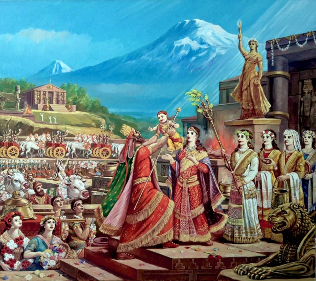
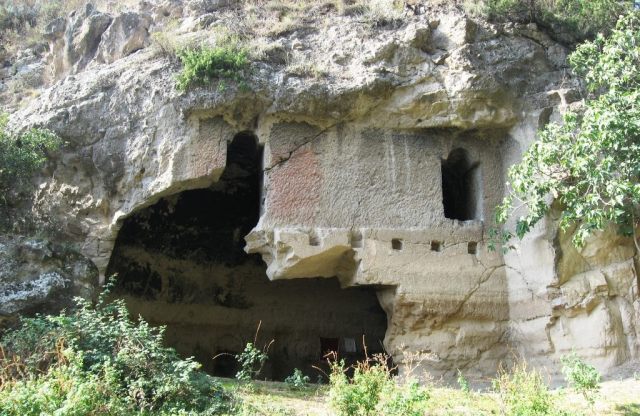
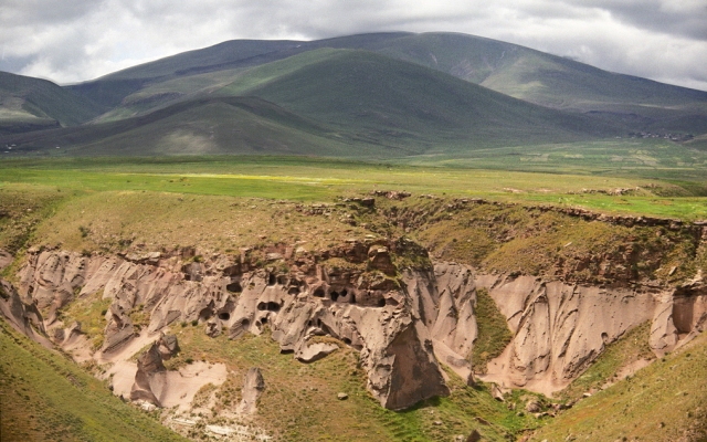
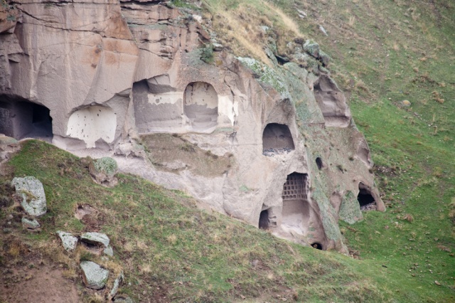
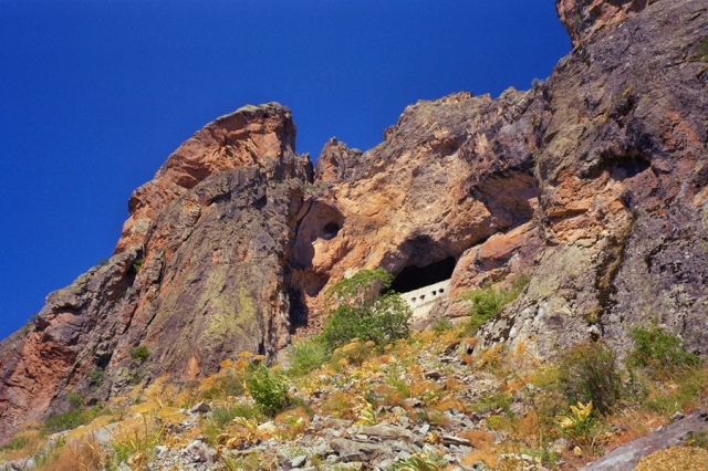
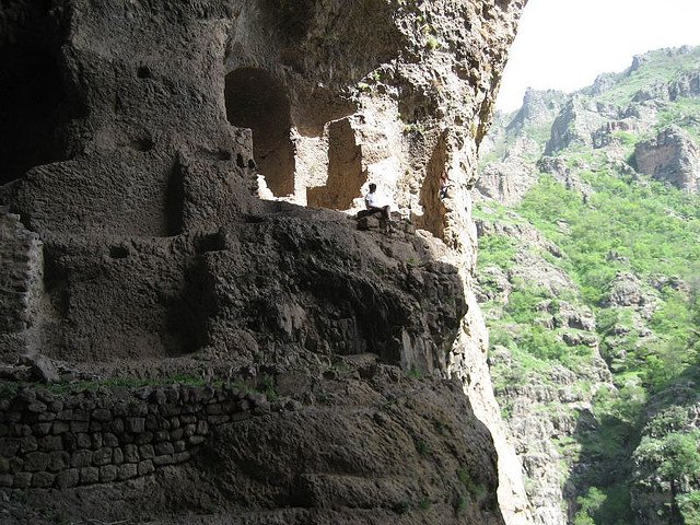
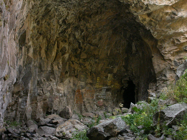
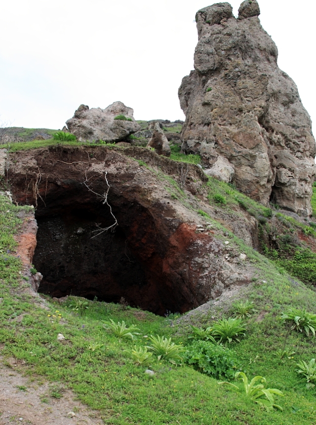
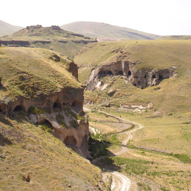
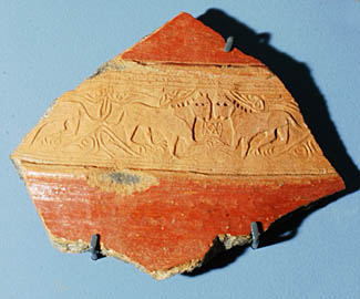
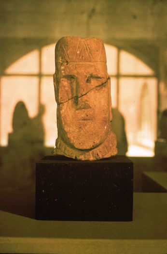
Aratta is a mountainous land that appears in Sumerian myths  identified by various scholars with Ararat (Ayrarat) of historical Armenia.[1][2][3][4][5] Aratta was considered a holy site (home to the goddess Inanna, analogue of Anahit) [6][7][8] famous for metallurgy, stone masonry, gold production, silver and their precious blue Azurite stones. Since the antiquity Armenia was known for the best quality of these mineral stones which are called Lapis Armenus, also known as Armenian stone in natural history. Lapis Armenus is a variety of precious blue Azurite stone, nearly identical to the Azurite known as lapis lazuli, occasionally used interchangeably [9][10] but distinguished by a finer structure sometimes containing greenish tints. The 1816 Encyclopedia Perthensis notes that Armenian stone “was anciently brought from Armenia to Europe”. Emanuel Mendes da Costa (1757) describes it having: “an elegant bright or clear blue color, sometimes of a deeper sometimes of a paler blue, and also sometimes with a greenish cast.”[11] The blue of Azurite is exceptionally deep and clear, and for that reason the mineral has tended to be associated since antiquity with the deep blue color of low-humidity desert and winter skies. Lapis Armenus was highly esteemed in antiquity, and attempts have been made to recreate it artificially. Sumerian king Enmerkar (ca. 2100 BC) in the epic “Enmerkar and the lord of Aratta” prays to the deity Inanna asking her to bring him precious materials from Aratta, including Azurite blue stones called “za-gin” in Sumerian epics.[12]

“My sister, let Aratta fashion gold and silver skilfully on my behalf for Unug. Let them cut the flawless [za-gin] (Azurite) from the blocks”… “Let the people of Aratta bring down for me the mountain stones from their mountain, build the great shrine for me, erect the great abode for me…”

John Hill (1748) in his work on minerals gives a historic account of the Armenian stone, describing it as follows:

“A glorious color for painting, and was in the highest esteem as such among the ancients. Theophrastus has recorded it, p. 130. that it was a thing judged worthy of a place in the Egyptian annals, which of their kings had the honor of inventing the factitious kind : and that it was a substance of that value, that presents were made to great persons of it ; and that the Phoenicians paid their tribute in it.”[13]

To some Greek writers it was also known as ‘kuanos’ (κυανός: “deep blue,” root of English cyan) and in Latin ‘caeruleum nativum’ (native blue or sky blue) usually mixed with green elements (called Chrysocolla).[13] Theophrastus (c. 315 BC) confirms that “the native kuanos” (or Lapis Armenus) has in it “Chrysocolla,” which, to the ancients, was a green oxide of copper.[14] Referring to the Armenian stone Pliny the Elder (1st c. AD) in his Natural History describes its preparation as follows:

“When chrysocolla has been thus dyed, painters call it “orobitis,” and distinguish two kinds of it, the cleansed orobitis, which is kept for making lomentum, and the liquid, the balls being dissolved for use by evaporation. Both these kinds are prepared in Cyprus, but the most esteemed is that made in Armenia, the next best being that of Macedonia: it is Spain, however, that produces the most. The great point of its excellence consists in its producing exactly the tint of corn when in a state of the freshest verdure. Before now, we have seen, at the spectacles exhibited by the Emperor Nero, the arena of the Circus entirely sanded with chrysocolla, when the prince himself, clad in a dress of the same colour, was about to exhibit as a charioteer.”[15]

The classical author Vitruvius (1st century BC) lists the Armenian stone by the name of Armenium and Pliny (77AD) lists this among his ‘florid’ colours (at a massive 300 sesterces per pound).[16]  In the 1759 book “The Modern Part of an Universal History” the authors mention Lapis Armenus whose veins “naturally represent flowers, trees, mountains and rivers.” And from it tables and other ornaments are being made.[17] Theophilus (1847) in his work also mentions its ornamental usage:

“The deep blue, “Lapis Armenus” or cyanus, is even now cut for ornaments ; some of this so closely resembles sapphirus or lapis lazuli that it is only by the test of fire, which destroys the blue colour of the native carbonate of copper, the two are to be distinguished.”[14]

The Azurite Lapis Armenus is often found in association with another copper carbonate; the Malachite [18] also known as the green lapis lazuli (also identified with the Latin Chrysocolla).[19] The Sumerian epic “Lugalbanda and the Anzud bird” mentions this Malachite in Arrata:

“Aratta’s battlements are of green lapis lazuli, its walls and its towering brickwork are bright red, their brick clay is made of tinstone dug out in the mountains where the cypress grows.” [20]

Classical historians would still remember these ancient mines. Roman physician Pedanius Dioscorides (1st century AD) says that the “finest comes from Armenia, the next best from Macedonia and after that the Cyprus, but this mineral is not obtained from any of these places today.”[21] It is also known to have been used for coloring ancient Chinese porcelain.[22]  The Armenian Azurite has been used as a pigment as early as the Fourth Dynasty in Egypt. It was no doubt the most important blue pigment in European painting from the fifteenth to the middle of the seventeenth century. The paintings of that period contain more ultramarine made from lapis Armenus, than from any other substance.[29]


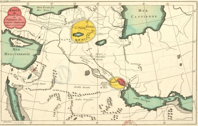
From Armenia to Babylon
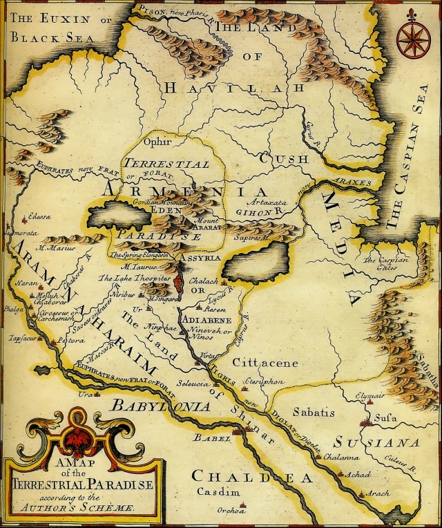
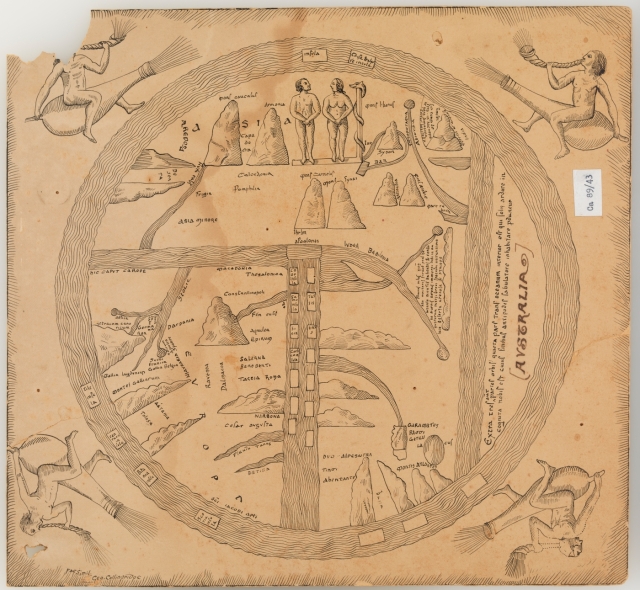
Babylonian map of the world (6th c. BC)

Babylonian map of the world (6th c. BC)

The method of transporting the “stones of the mountain” from Aratta to Uruk and of transporting grain from Uruk to Aratta, as described in the Sumerian myths, seems consistent with such trade historically between the Armenian highlands and areas to its south, namely, by boat from Aratta toward the south, and by pack animal from Uruk towards the north. Extensive trade between Armenia and Babylon was well known in the ancient world. The Greek historian Herodotus (c.a. 450 BC) in his work “The Histories”: I:194 provides some details on cargo transport between Armenia and Babylon: 

But the greatest marvel of all the things in the land after the city itself, to my mind is this which I am about to tell: Their boats, those I mean which go down the river to Babylon, are round and all of leather: for they make ribs for them of willow which they cut in the land of the Armenians who dwell above the Assyrians, and round these they stretch hides which serve as a covering outside by way of hull, not making broad the stern nor gathering in the prow to a point, but making the boats round like a shield: and after that they stow the whole boat with straw and suffer it to be carried down the stream full of cargo; and for the most part these boats bring down casks of palm-wood filled with wine. The boat is kept straight by two steering-oars and two men standing upright, and the man inside pulls his oar while the man outside pushes. These vessels are made both of very large size and also smaller, the largest of them having a burden of as much as five thousand talents’ weight; and in each one there is a live ass, and in those of larger size several. So when they have arrived at Babylon in their voyage and have disposed of their cargo, they sell by auction the ribs of the boat and all the straw, but they pack the hides upon their asses and drive them off to Armenia: for up the stream of the river it is not possible by any means to sail, owing to the swiftness of the current; and for this reason they make their boats not of timber but of hides. Then when they have come back to the land of the Armenians, driving their asses with them, they make other boats in the same manner. [23]

Medicinal Powers of Lapis Armenus

Lapis Armenus medical value

From “The Anatomy of Melancholy, what it is: With All the Kinds, Causes, Symptons, Prognostics, and Several Cures of it, Volume 2″ by Robert Burton (1871)

Lapis Armenus has often been credited with medicinal and sometimes even magical powers. Among many other things lapis Armenus was used to cure depression, elephantiasis, asthma, kidney problems, infections and melancholia. [24] In medicine according to Dr. Grew (1757), “it is highly celebrated by some, not only for its innocent and most easy, but also most effectual operation, in such diseases as are supposed to depend on melancholy.”[11]. Nicholas Meripsa puts it among the best remedies, in his book Antidotis: “and if this will not serve (saith Rhasis) then there remains nothing but Lapis Armenius and hellebore itself.”[25] Similarly, Isidore Kozminsky (2012) in his recent book “Crystals, Jewels, Stones: Magic & Science” describes some of its medical properties:

“Lapis Armenus, or Armenian Stone, is a copper carbonate used as a medicine against infection. It is related in Arab books that a solution of this substance will retain its power for 10 years. In the East copper has been long used as a safeguard against cholera, and it has been observed that workers in copper mines have enjoyed immunity from the disease. The Lapis Armenus, like all copper compositions, is under the rule of the planet Venus.” [26]

Burton (1871) recounts physicians who speak highly of this substance:

“”That good Alexander” (saith Guianerus) “puts such confidence in this one medicine, that he thought all melancholy passions might be cured by it; and I for my part have oftentimes happily used it, and was never deceived in the operation of it.” The like may be said of lapis lazuli, though it be somewhat weaker than the other. Garcias ab Horto, hist. lib. 1. cap. 65.relates, that the physicians of the Moors familiarly prescribe it to all melancholy passions, and Matthiolus ep. lib. 3. brags of that happy success which he still had in the administration of it.”[25]

In the Arab world Lapis Armenus was famously used by doctors as a remedy or natural cure against vertigo, melancholia, and epilepsy. The lapis Armenus was well known to the Arabs under the name “Hajer Armeny”, and their medical writers describe it quite accurately. Ibn Beithar states that if properly prepared it would not provoke nausea, as was otherwise the case. It was said to cause a very abundant evacuation of bile and must have been regarded as an efficient remedy for the bilious disorders so general in warm climates.

A “blue amulet” against vertigo, melancholia and epilepsy could be made up of the following ingredients: shavings from an elk’s horn and from a human skull, to be reduced to a fine powder, the excrement of a peacock, white agate, lapis lazuli or lapis Armenus, of which enough was to be used to give the required sky-blue tint. The whole mass was then to be softened by the addition of gum tragacanth, and formed into heart-shaped tablets, which were to be dried out in the air, and then smoothed on a turning-lathe. These amulets were to be worn attached to the neck or the arm, sometimes they were enclosed in a little receptacle of silver or of red sandal-wood and suspended from the neck. (J.J. Kent, 2004)

Regarding the length of time during which various preparations retained their strength, Braunfels (1997) states that, according to the opinion of the Arabian physicians, the solution of lapis Armenus lasted for ten years, while that of lapis lazuli could be preserved only about three years. [28]  Pliny too mentions a blue Azurite pigment from Armenia, which was used “in medicine to give nourishment to the hair, and specially the eyelashes” (N.H. 35:28) [19] Physicians used to select lapis Armenus that is smooth, blue, non-granular and easily pulverized. [21]


SOURCES:

[1] Kavoukjian M. (1978) Armenia, Subartu and Sumer

[2] Nazaryan G. (2008) Armenian Highland

[3] Movsisyan A. Armenia in spiritual concepts of Ancient world. Armenological Encyclopedia

[4] Artak Movsisyan (1992) Aratta: The ancient Kindgom of Armenia, Yerevan

[5] Artak Movsisyan (2001) Aratta: Land of the Sacred Law, Yerevan

[6] Boyce, Mary (1982), A History of Zoroastrianism, Vol. II, Leiden/Köln: Brill

[7] Cumont, Franz (1926), “Anahita”, in Hastings, James, Encyclopedia of Religion and Ethics 1, Edinburgh: T. & T. Clark

[8] Lommel, Herman (1927), Die Yašts des Awesta, Göttingen-Leipzig: Vandenhoeck & Ruprecht/JC Hinrichs

[9] George Perkins Merrill, Margaret W. Moodey, Edgar Theodore Wherry (1922) Handbook and Descriptive Catalogue of the Collections of Gems and Precious Stones in the United States National Museum, Issues 118-120

[10] 1998 Webster’s

[11] Emanuel Mendes da Costa, (1757). A natural history of fossils

[12] Enmerkar and the lord of ArattaETCSLtranslation : t.1.8.2.3 

[13] John Hill, Thomas Osborne, (1748) A General Natural History Or, New and Accurate Descriptions of the Animals, Vegetables, and Minerals, of the Different Parts of the World

[14] Theophilus (1847), Theophili, qui et Rugerus, presbyteri et monachi, libri III. de diversis artibus: seu, Diversarum artium schedula  

[15] Pliny the Elder, ( 1st c. AD ) The Natural History, Chap: 27 

[16] Valentine Walsh, Tracey Chaplin (2008), Pigment Compendium: A Dictionary and Optical Microscopy of Historical Pigments, Routledge 

[17] S. Richardson, T. Osborne, C. Hitch, A. Millar, John Rivington, S. Crowder, P. Davey and B. Law, T. Longman, and C. Ware, (1759) The Modern Part of an Universal History: From the Earliest Account of Time. Compiled from Original Writers. By the Authors of The Antient Part  

[18] Dictionary of Traded Goods and Commodities, (1550-1820) British History Online

[19]  George Robert Rapp (2009) Archaeomineralogy

[20] Enmerkar and the lord of ArattaETCSLtranslation : t.1.8.2.2

[21] Geological Society of America (1955), De Natura Fossilium: Textbook of Mineralogy

[22] Charles Alfred Speed Williams (1941), Chinese Symbolism and Art Motifs: An Alphabetical Compendium of Antique Legends and Beliefs, as Reflected in the Manners and Customs of the Chinese

[23] Herodotus (c.a. 450 BC) The Histories: I:194

[24] C.J. Duffin, R.T.J. Moody, C. Gardner-Thorpe, (2013) A History of Geology and Medicine

[25]  Robert Burton (1871),  The Anatomy of Melancholy, what it is: With All the Kinds, Causes, Symptons, Prognostics, and Several Cures of it, Volume 2  

[26] Isidore Kozminsky, (2012), Crystals, Jewels, Stones: Magic & Science 

[27] J.J. Kent, 2004

[28] George Frederick Kunz, (1997) The Magic of Jewels and Charms

[29] Attila Gazo (2010) Attila Gazo


Ancient cave dwellings of Armenia

$
0
0
Ancient cave-dwellings of Khndzoresk

Ancient cave-dwellings of Khndzoresk

Armenian Highland is distinguished with countless ancient cave dwellings, dating far back into history of human settlement. Discoveries in the Areni cave complex in Armenia yielded phenomenal finds such as the discovery of the world’s oldest leather shoe (5,500-year-old), oldest wine making facility (6,100-year-old), a straw skirt dating to 3900 BC, singes of animal domestication and even a well preserved human brain. There is almost every kind of cave in Armenia, there are man made caves and even caves of hydrothermal origin, which are very rare in the world. These hollows originate when lava from the inner core of the earth mixes with hot springs, creating caves.  We also know that people themselves created caves. Elaborate and often architecturally magnificent, monastery complexes with entire villages, carved out of rock, are found in abundance on the Armenian plateau. Armenians used caves as fortresses, places of worship, as housing, as storage facilities and as shed for the animals. Because of minimal airflow, these caves are warm in winter and cool in summer. Armenian cave-dwellings were well known to the ancient classical writers. Xenophon during his journey in Armenia describes an Armenian village as follows: 

“Their houses were under ground, the entrance like the mouth of a well, but spacious below; there were passages dug into them for the cattle, but the people descended by ladders. In the houses were goats, sheep, cows, and fowls, with their young; all the cattle were kept on fodder within the walls. There was also wheat, barley, leguminous vegetables, and barley-wine, in large bowls.”[1]

Living in caves was common during the entire Armenian history. Such caves were used as dwellings in Armenia until the 1960s. Today, in the villages of Tegh and Khndzoresk in the Syunik marz, caves are still used as cellars and cow-sheds.

Mr. Curzon in his Armenia (cf. Taylor’s N.) gives a detailed account of the construction of these cave houses in Armenia.

“First a site is selected on the side of a gently sloping hill. Then a space as large as the proposed house is excavated. This is divided off into quarters for the stock and rooms for the family by walls and rows of wooden columns, eight or nine feet high. Over these large branches of trees are laid, with a thick layer of smaller branches and twigs on top. Then a large part of the earth taken out in the excavation is spread above, and a layer of turf completes the roof. The houses are now entered through door-ways on the lower side, which is built up four or five feet above the grade of the slope.”[2]

Some cave-dwellings found throughout the Armenian plateau are distinguished with a stone door. The Speleological Center of Armenia has discovered more than 160 man-made structures carved into rocks and caves that were inhabited in the area from Talin to Ashtarak and Araler-Aragats. They differ from other man-made caves in other regions of Armenia with regard to the stone doors. Caves with stone doors have a cave-hall, a stone door and a secret entrance, in the form of a tunnel with specific masonry. They were mainly used as hidden storehouses for the food of small groups of people or communities. Only a few trusted people had access to these reserves.  At the end of the tunnels, there were stone-doors that swung inward.

These doors were a fundamental feature of the caves. If there was a hidden tunnel, there was always  a stone door at the end. The stone doors had pegs near the top that fit into specially carved holes in the frames. Both doors and frames were well-finished. Even today, these doors can be opened and closed. It is unknown when these doors were built, but by the 18th century, they had no practical use anymore. Ancient Armenian writers wrote about them as amazing, unusual structures granted to humans by mythical giants. According to the Speleological Center, caves with such stone doors are often found in the Aragatsotn marz. But there are no rock-carved churches in this region, and the churches that were built from the 5th to the 16th centuries don’t have stone doors. Thus, they conclude that such stone door caves are related to a pre-Christian culture.[3]


Bellow more pictures of cave dwellings in Armenia.

Kronk cave church (12-13 c) in the Tsaghkaberd village, Qashatagh region

Kronk cave church (12-13 c) in the Tsaghkaberd village, Qashatagh region


The Areni-1 cave complex in the Areni village of southern Armenia along the Arpa River. Descoveries in the complex revealed the among other artifacts: the oldest shoe and the oldest known winery.

The Areni-1 cave complex in the Areni village of southern Armenia along the Arpa River. Descoveries in the complex revealed the among other artifacts: the oldest shoe and the oldest known winery.


6,100 year old Wine making press (oldest known) discovered in Armenian Cave.

6,100 year old Wine making press (oldest known) discovered in Armenian Cave.


Armenian Cave Monastery

Geghard 4th century Armenian Cave Monastery.


Ancient Armenian cave dwellings of Ani

Ancient Armenian cave dwellings of Ani


Ancient rock-carved village in Ani. Erosion over the centuries have exposed home interiors.

Ancient rock-carved village in Ani. Erosion over the centuries have exposed home interiors.


The entrance to a rock-cut church in the Gayledzor valley cave complex.

The entrance to a rock-cut church in the Gayledzor valley cave complex.


Rows of pigeon holes of a dovecote inside a rectangular chamber in the Igadzor valley cave-complex.

Rows of pigeon holes of a dovecote inside a rectangular chamber in the Igadzor valley cave-complex.


Lastiver pagan Cave dweling

Lastiver pagan Cave dweling


Lastiver pre-Christian cave

Lastiver pre-Christian cave


Lastiver pre-Christian cave

Lastiver pre-Christian cave


Apse of the rock-cut chapel of the Armenian Monastery, Derevank.

Apse of the rock-cut chapel of the Armenian Monastery, Derevank.


Caves near the village of Tegh

Caves near the village of Tegh


Entrance to the Monastery of the Holy Virgin Mary (5th Century) on a cliff overlooking the village of Kayadibi, near Shabin Karahisar (Arm. Koghonia, Koloneia), looking east.

Entrance to the Monastery of the Holy Virgin Mary (5th Century) on a cliff overlooking the village of Kayadibi, near Shabin Karahisar (Arm. Koghonia, Koloneia), looking east.


Entrance to the Monastery of the Holy Virgin Mary (5th Century) on a cliff overlooking the village of Kayadibi, near Shabin Karahisar (Arm. Koghonia, Koloneia), looking east.

Entrance to the Monastery of the Holy Virgin Mary (5th Century) on a cliff overlooking the village of Kayadibi, near Shabin Karahisar (Arm. Koghonia, Koloneia), looking east.


Ancient cave-dwellings of Khndzoresk

Ancient cave-dwellings of Khndzoresk


Ancient cave-dwellings of Khndzoresk

Ancient cave-dwellings of Khndzoresk


Khosrov Armenia, inhabited lron ago caverns

Khosrov Armenia, inhabited lron ago caverns


Ancient cave-dwellings of Khndzoresk

Ancient cave-dwellings of Khndzoresk


Lastiver pre-Christian cave dwellings

Lastiver pre-Christian cave dwellings


Cave entrance to Geghard 4th century monastery.

Cave entrance to Geghard 4th century monastery.


Lernanist (Surbi, Aphrey) cave

Lernanist (Surbi, Aphrey) cave


Ancient man-made cave made from rocks

Ancient man-made cave made from rocks


Lazar's cave Alaverdi-Armenia

Ancient Lazar’s cave Alaverdi-Armenia


Recently discovered 5th century Armenian Tzarakar monastery.

Recently discovered 5th century Armenian Tzarakar monastery.


The 5th century Armenian Tzarakar monastery.

The 5th century Armenian Tzarakar monastery.


The conchas of the hall and sanctuary of the main church of Tzarakar Monastery

The conchas of the hall and sanctuary of the main church of Tzarakar Monastery


Khndzoresk - cave settlement

Khndzoresk – cave settlement


Ancient Ani cave complex

Ancient Ani cave complex


Sources:

[1] http://www.gutenberg.org/files/22003/22003-h/22003-h.htm#FNanchor_218_218

[2] https://archive.org/details/xenophonsanabas00zenogoog

[3] http://hetq.am/eng/print/8079/


Mount Ararat on historic Armenian coins

$
0
0

A collection of historic Armenian coins depicting legendary mount Ararat.


230 BC.

Armenian kingdom of Sophene, Arsames II, 230 BC

Coin from Armenian kingdom of Sophene, bust of Arsames II, 230 BC. Mountain peaks of Ararat on the reverse with stars shining above the peaks.

More examples:

EXAMPLE 1

EXAMPLE 2

1st c. BC.

Tigranes IV king of Armenia 2 BC-AD 1. Busts of Tigranes, wearing Armenian tiara and diadem, and right, the two peaks of Mount Ararat, as seen from the Armenian capital Artaxata.

Tigranes IV king of Armenia 2 BC-AD 1. Busts of Tigranes, wearing Armenian tiara and diadem, and right, the two peaks of Mount Ararat, as seen from the Armenian capital Artaxata.

More examples:

EXAMPLE 1

EXAMPLE 2

1989 USSR

Soviet Armenian coin in memory of the devastating earthquake (1989)

Soviet Armenian coin in memory of the devastating earthquake (1989)


2012

50 dram Armenian coin

50 dram Armenian coin


2013

Armenian silver coin Noah's ark and mount Ararat 2013

Armenian silver coin Noah’s ark and mount Ararat, 2013


Ancient Armenian bracelet (3rd-1st century BC.)

$
0
0
Armenian bracelet from the 3rd-1st century BC. Depicting two beautifully crafted rams heads on both sides. From the Harvard Art Museum.


Brass, silvered with traces of gilding
4.3 x 4.2 cm (1 11/16 x 1 5/8 in.)
 
Armenian bracelet (3rd-1st century BC.) Depicting two rams heads on both ends.

Armenian bracelet (3rd-1st century BC.) Depicting two rams heads on both ends.


Discovering the kingdom of Van

$
0
0

Did you know that the discovery of the ancient kingdom of Urartu/Ararat was made due to records from a medieval Armenian history book?

Well, the existence of the Kingdom of Ararat, or Urartu, was unknown to science until the year 1823 when a French scholar, J. Saint-Martin, chanced upon a passage in the ‘History of Armenia’ by Movses Khorenatsi, the Armenian historian of the fifth century A.D. who had recorded the kingdom in great detail. Inspired by these writings Jean Saint-Martin sent a team to the described location and discovered a kingdom completely unknown to western academia.

Armenian medieval historians were well aware of the old Armenian Kingdom of Van. Khorenatsi had described Urartian settlements in Van and attributed them to the legendary Armenian hero Ara the Beautiful also known as Aram. His description exactly matched, the later discovered, Assyrian clay tablet attributing the foundation of the kingdom to the first king of Urartu; king Aramu (c. 860 – 843 BC)

According to M. Chahin:

“Urartian history is part of Armenian history, in the same sense that the history of the ancient Britons is part of English history, and that of the Gauls is part of French history. Armenians can legitimately claim, through Urartu, an historical continuity of some 4000 years; their history is among those of the most ancient peoples in the world.”

- Mack Chahin, The Kingdom of Armenia, A History, 1987, revised in 2001

Didi you know how Urartu was descovered2


Gagkashen church

Finding Noah Official Trailer

Viewing all 92 articles
Browse latest View live